Oregon - Three Sister Loop
2019-09-11
When my friend and I was planning a backpacking trip during the labor day weekend we browsed through numbers of destinations listed on Clever Hiker, the Three Sister Loop caught our attention as it is only 3 hours drive from the Portland airport, the accomadations are relative cheap and September is the dry season there with ideal temperature for hiking. Also no permits are required to complete the loop and you can camp anywhere for most part of the loop which makes it very convenient to plan the trip.
I followed HOW WE CIRCUMNAVIGATED THE THREE SISTERS for guidence and used Backpacklight Thread and Oregon Hiker for additional campsite / water source / side trip information. I think the route itself is straightforward but just not as many water sources along the way as my previous backpacking trips. Many of the creek shown on map are actually dried up.
Our Route
We followed the instruction and started at Pole Creek Trailhead therefore the Pole Creek burn area were divided into two half days. It turned out to be a wise decision as hiking through the burn area on a sunny day can be very tough both physically and mentally and the lack of water source added more stress on top.
The Pole Creek Trailhead has the shortest entrance/exit point, making the route roughly 46 miles and the out-and-back section only about 2 miles.
Our chosen route was clockwise, heading south from Pole Creek to Moraine Lake on the Green Lakes Trail connecting via the Moraine Lake Trail and the LeConte Crater Trail. From there, we would then connect with the Pacific Crest Trail and head north towards South Matthieu Lake, then connect on the Scott Pass Trail. If we followed the instruction we should go back to Green Trail but we ended up hiking on tracks for off-road vehicles through the burn area on our last day out.
Day 0.5
Pole Creek Trailhead - Park Meadow
6.7 Miles
We left the hotel near Portland and stopped by Walmart to get some water and gas for this trip. And then had Mcdonald’s for lunch near the trail head. We had much late start than I initially planned and didn’t hit the trail until 4PM. Apparently, we couldn’t make it to Green Lake Area before sunset, so we decided to camp at Park Meadow which is the last water source before Green lake. Park Meadow has a running stream providing good drinking water and some trees to protect us from the wind. We barely made it to the campsite before sunset and used every second of daylight to pitch the tent and cook dinner.


Day 1
Park Meadow - Mesa Creek
14.4 Miles
We woke up the next day with sunlights dancing on the meadow and saw a couple relaxing on their portable chairs in the open meadow and enjoying their morning coffee with a view of the mountain. I wish we could do that if haven’t we planned a lot of mileage for that day!

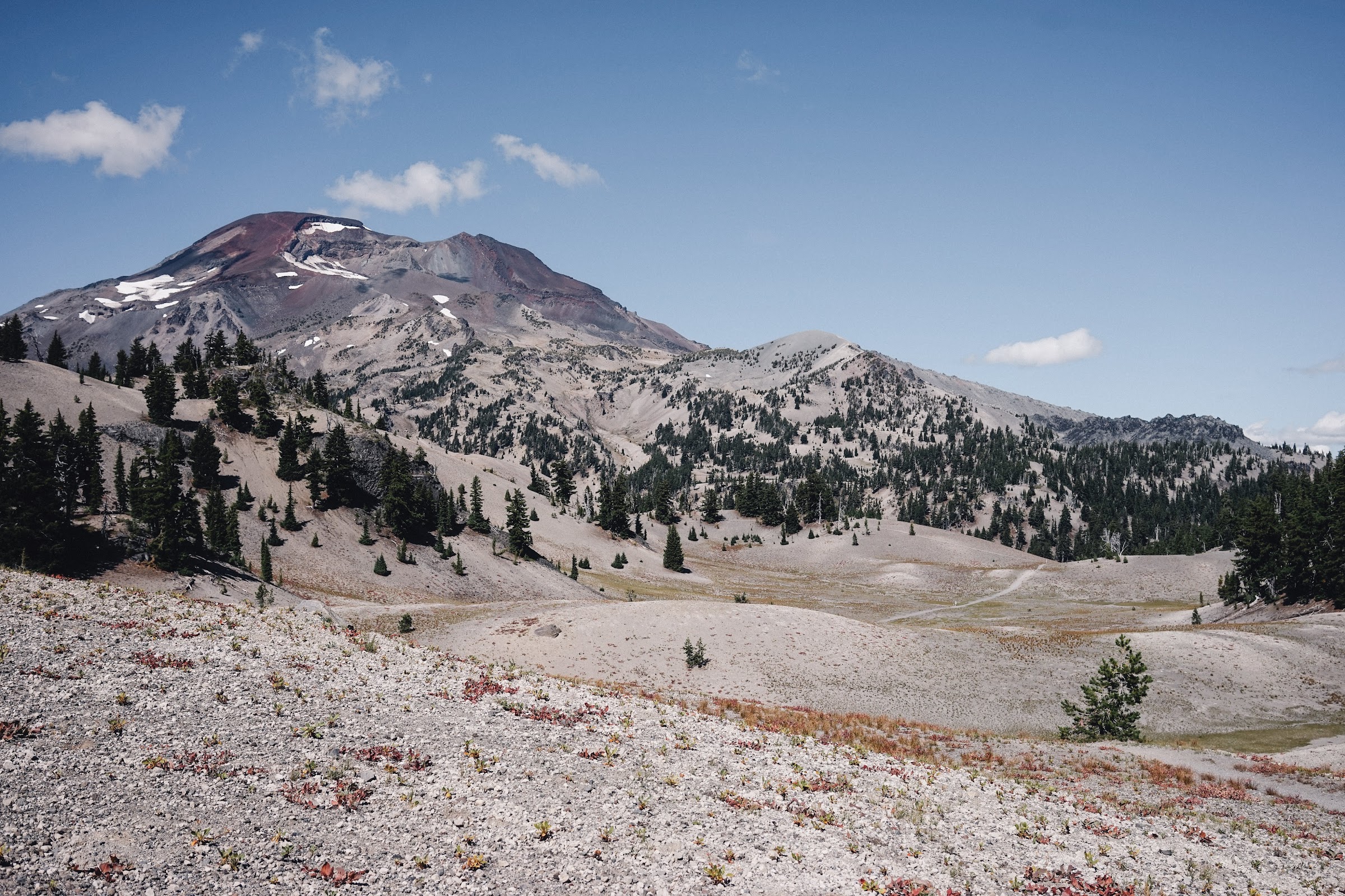
After a quick breakfast we packed our stuffs and continued down the Green Lake trail and after one hour of hiking through exposed area with great view of the Sisters, we reached the high point of this trip at 7000 ft. The trail then went down to the basin where sits three adjunct lakes. It was a pure joy overlooking Green Lakes from the top of the pass as the view slowly opening up as you hike through some lodgepole pines.


![]()
There were at least 20 people coming from the opposite direction on Green Lake Trail as we continued down the trail. We followed the Green Lake Trail until we met Moraine Lake Trail and lost the crowds. Since we have desceded all the way from Green Lakes, it was time to have some climbs. The trail to Moraine Lake is mostly uphill but not very steep. As we have decided to have a late lunch at Moraine Lake, our energy level were low at that point which made the climb harder.
Finally, we reached Moraine Lake around 1PM. Moraine Lake is smaller compared to the Green Lakes, but it gives you a open view of the South Sister. Resting by the lake, we can see a pass leading toward the summit of South Sister. We ate our lunch by the lake and had our water bottle filled. There were so many Chipmunks around us and one jumped over my shoes and tried to stole my snacks. They are fearless!


It was just too cozy there that I almost didn’t want to leave. Followed the trail we went uphill and had a final look of the lake. We then entered into the dry area. The walk through the forest in the afternoon was very nice. There were some shades and a little breeze to kept us cool from the evening heat.


The trail kept going up and down, in the forest and out to the meadow and back into the forest. As we merged with Pacific Crest Trail, we encountered some thru-hikers along the way. Most of them are NOBO at this point of the year, since they are pretty close to their finish line they walked really fast. Going uphill as if they were not carrying anything on their back!
This part of the hike in the afternoon were pretty boring since the view didn’t change much and we were out of shape and feeling tired. As the time went by and we were still a mile or two away from the Reese Lake and we passed by this little pond after the Mesa Creek and decided to call it a day. The campsite has a decent size, it was soft and flat ground surrounded by pines. People before us apparently setup a nice camp fire but we were both too tired to do that. The water quality from that little pond was not ideal but we managed to filter the water and boiled them for our instant noodle dinner.
We finished dinner by the sunset and managed to go to bed around 8:30PM. I was woked up by another group of people at late night. In the morning I found out that they set up their tents below ours by the pond.
Day 2
Mesa Creek - South Matthieu Lake
15.3 Miles
We started off the day early after getting a sound 10 hrs sleep. We made it to Reese Lake quickly and filled up our water bottle since we didn’t want to drink the water from the little pond at our campstie even if they got filtered.
Reese Lake is also small and shallow lake but the water is better than our little pond. The area itself however is very expose with no wind protection from trees. We were both very happy about our choice of the campsite last night.
We had some quick bites while filtering the water and set out to the Obsidian Limited Entry Area, a special landscape featuring young lava flows and obsidian cliffs. There was barely any water source from Reese Lake to Obsidian Fall, and the Linton Spring on the map was off the trail and I could’t locate it. Luckily, we brought enough water.


The trail leading toward Obsidian Fall are mostly flat and a bit uphill when it meets Obsidian Trail. There was a very short sidewalk to the Obsidian Fall, but we didn’t stop to check it out. We climbed straight up to the upper side of the fall where there is a nice creek waiting for us. We dropped our backpacks and enjoyed a peaceful lunch under the shades. There were several PCT hikers passing by while we were having lunch and one sat down to refill his waterbottle. I am amazed by how efficient they managed to eat, rest and fill water.
After the Obsidian Fall, we passed one more creek and then started going uphill again. The top of the hill is a flat platform where you can see multiple mountain tops within distance.

The trail went back down into the forest and then climbed up again when closed to Sawyer Bar. On the left of the trail it was a pile of rocks formed by lava flow and on right side it was the pine trees forest. The climb was slow and consistant and we decided to take a water break at the end of Sawyer Bar before hitting the exposed Opie Dildock Pass.
It was worth to mention that, although there is a little creek shown on the map in Sawyer Bar, it was actually dried up at the time we were there.
We took a very needed rest before heading towards Opie Dilldock Pass. Hiking on lava flow formed terrain was a very unique experience. The rocks are softer than granite and looser when piled up, more of a sandy beach feeling. The hike up was steep but short, with temperature going up in the afternoon and no shades high up there, we expected it to be a sweaty climb. However the pass itself is above the treeline which makes it quite windy. In a sunny day like this, the headwind carried away the afternoon heat and made it quite comfortable to hike up.
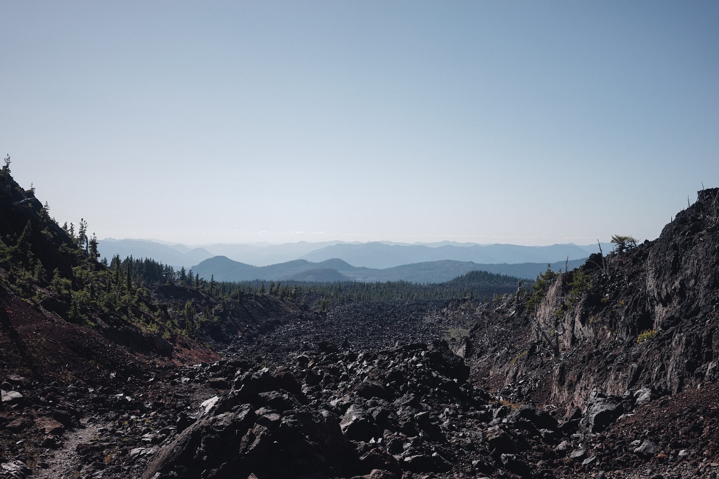
The view out there at the top of the pass was amazing. Standing on high point of the northwest side of the trail at 6900', you get great closeup views of the Middle and North Sisters and to areas north including Mount Washington and Mount Jefferson. Walking on the ridge, we both felt that we were on the Mars, if it was not the pine tree that reminded us the exisitence of lifes out there!


Other trip reports mentioned that just past Opie Dilldock, there is Minnie Scott Spring which is a very very tiny spring but with good quality of water. I was initially planning to camp there for the night, but the sun was still high up there so we decided to continue our way to South Matthieu Lake. Between Minnie Scott Spring and South Matthieu Lake it was pretty dry.
After a short walk in the forest, we were out on lava land again, this time around the Yapoah Crater. This cinder cone juts up from nowhere and distinguished itself from the surrounding terrian. That is how it earned its name, Yapoah, a nativer term of an isolated hill. There is a user trail going up to the top of the crater from the north side, but the PCT just skirted around the base of the crater. Once passing the crater, the trail became flat, just another mile of walk on the laval flow terrian.
By the time we arrived at South Matthieu Lake it was around 5:30PM. South Matthieu Lake is a designated campsite area with only three campsites. We were uncertained if the spots were all taken, but as the ranger told us earlier, we can just camp outside the South Matthieu Lake area after filling up our water bottels. Or we can hike north to North Matthiew Lake which has more campsites. We circled around the lake and were luckily enough to grab one of the spot left. It was big and flat, enough room for a large group. We felt reliefed after securing the campsite and sat there for a while just enjoying the sunset and cellphone receptions!
Day 2.5
South Matthieu Lake - Pole Creek Trail Head
9.6 Miles
I was mentally done with this trail after day 2. I thought the way back to trail head would be easy since it would be mostly flat with only some downhills. I was aiming to get to the trail head by noon but apparently I underestimated the distance and the heatwave in the burn area around noon.
We set out earlier in the morning and followed the Scott Trail down the hills. It was cloudy in the morning, perfect weather to hike. We were pretty happy and chatted a lot on our way down. When we hit the conjunction of Scott Trail and Green Lake Trail, we followd our trail map on Gaia GPS to continue down the Scott Trail until we got to the trail head. We then walked on semi-paved road for a while and back to an off-road trail for cars. At that point, we were back down to the flat ground in burn area surrounded by charcoaled trees. There was no breeze and the sun was brutal. The constant unchanging scenary of burning trees made me depressed. I decided to look down to the road in front of me and block all other surroundings with my hat. It was the first time that I ever felt that time hangs heavy on my hands.
After four and half hours of hiking, we finally made back to the car. And the first thing we did was to go to Mcdonald’s again and eat some real meals.
If You Go
The Three Sisters Wilderness Area covers 281,190 total acres, making it Oregon’s second largest wilderness areas as well as one of the most popular.
Wilderness permits are required for both day use and overnight stays from Memorial Day weekend through October. Currently free permits are self-issued at the trailhead (after filling that up remember to take the receipt with you). However due to heavy use, the Three Sisters Wilderness Area will likely incorporate a permit quota system in 2020.
Please be aware of that water source is not as abundant as other trails and fill up your water bottle once you found one.
Categories: Trip Report Tags: Oregon Backpacking